-
Notifications
You must be signed in to change notification settings - Fork 3
Home
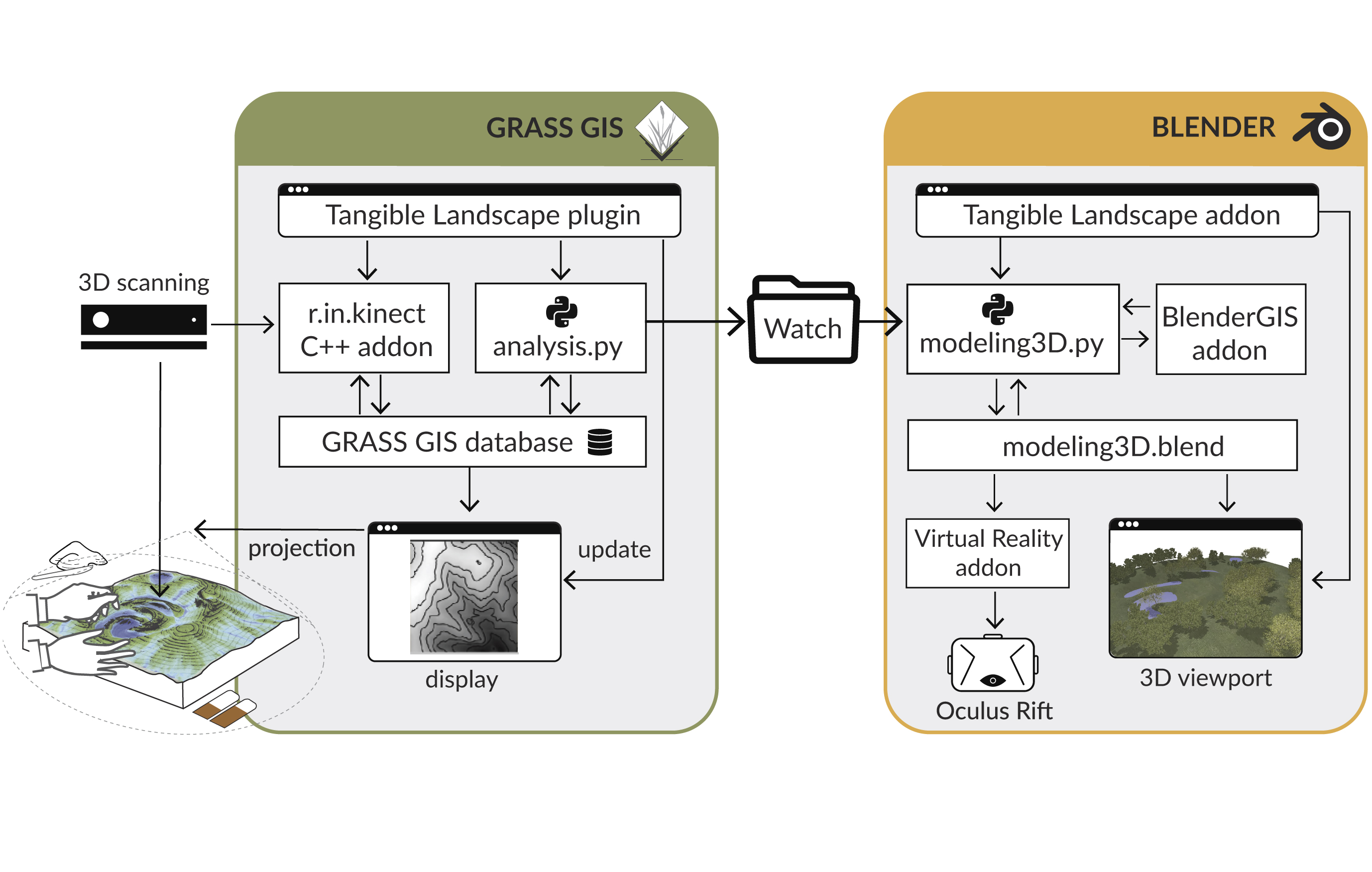
Blender and GRASS GIS are loosely coupled through file-based communication established via a local wireless or Ethernet connection. GRASS GIS exports the spatial data as a standard raster, a vector, or a text file containing coordinates into a specified directory typically called Watch (Figure setup). The Tangible Landscape Blender plugin (modeling3D.py)—implemented and executed inside Blender— constantly monitors the directory for incoming information. Examples of spatial data include a terrain surface (raster), water bodies (3D polygons or rasters), forest patches
(3D polygons), a camera location (3D polyline, text file), and routes (3D polylines).
Upon receiving this information, the file is imported using the BlenderGIS add-on.
Then the relevant modeling and shading procedures for updating an existing 3D
object or creating a new 3D object are applied. The adaptation procedure applied
depends upon the type of spatial data and is handled by a module called adapt. All
3D elements in the scene (i.e. objects, lights, materials, and cameras) reside in a
Blender file (modeling3D.blend).
