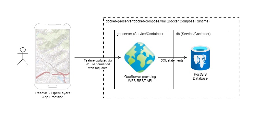
A sample application with a React/OpenLayers frontend that writes feature data to PostGIS using GeoServer WFS Transaction support.
The backend PostGIS/GeoServer is provided via the kartoza/docker-geoserver repo, which is included as a git submodule. The app frontend UI code is contained in this repo and based on create-react-app.
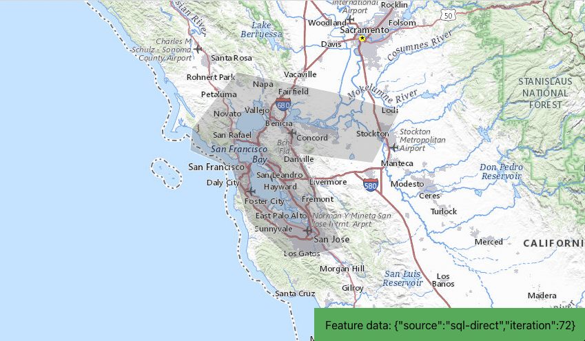
Clicking on the feature will add 1 to the feature's iteration property in the UI, and use a WFS Transaction to write the update to PostGIS using logic in the OpenLayers map onclick callback function.
Other notes:
- A WFS layer containing the feature is created and added to the OpenLayes map
- React refs are used to maintain OpenLayers object references between React renders, and make the objects available to the callback function
First initialize the git submodule used for the kartoza/docker-geoserver image:
git submodule update --init --recursive
Then install React/Node dependencies with the following command:
nvm use
npm install
The backend servers can be started with docker-compose. From the repo root:
cd docker-geoserver
docker-compose up -d
PostGIS should be reachable at: postgresql://docker:docker@localhost:32767/gis.
GeoServer should be available at: http://admin:myawesomegeoserver@localhost:8600/geoserver/web/.
Against the PostGIS instance, execute the following SQL commands to create a table named generic and a sample record. Make sure the table includes a primary key, or GeoServer will not be able to perform updates to the underlying row!
CREATE TABLE public.generic (
    id bigint NOT NULL,
    type character varying,
    geometry public.geometry NOT NULL,
    data json
);

ALTER TABLE public.generic ADD CONSTRAINT generic_pk PRIMARY KEY (id);

ALTER TABLE public.generic OWNER TO docker;

INSERT INTO public.generic VALUES (0, 'polygon', '0103000020E6100000010000000D00000033F47CA192B65EC00B8F9772F6014340AC087DA1B89F5EC0D2CCBCDF462F43408FA17CA1726D5EC0C1368D5BB91E4340A20E7DA1C04C5EC0FCDD0E23CD0F4340F7D07CA1765A5EC01D1EAF5F39E64240F5F37CA1BA7F5EC0376020AA71ED424034597DA17A745EC0C6688AAF84CB424088C77CA13A695EC0921437E6A3A14240FCCD7CA1F2835EC059A299581F9842404D3B7DA1189A5EC01573218E70B742405CEF7CA188A25EC097B01043C7E1424070287DA1A0B75EC0D7AD5E2B38F0424033F47CA192B65EC00B8F9772F6014340', '{"source":"sql-direct","iteration":32}');
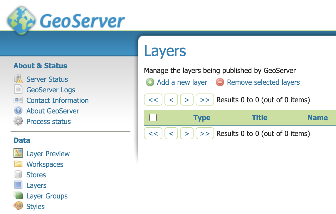
Next, log into the GeoServer instance: http://admin:myawesomegeoserver@localhost:8600/geoserver/web/
Create a new Workspace called dev.
Next we need to create a Data Source. Select the PostGIS type under Vector Data Sources.
- Data Source Name:
generic - Host:
db(internal connection between docker containers; usingdocker-composeservice name) - Post:
5432 - Database:
gis - Schema:
public - User:
docker - Password:
docker - Important! SSL Mode:
ALLOW(required for these docker containers to talk to each other)
Finally we will create a new Layer that publishes the generic table we created in PostGIS.
When creating the layer, make sure to generate the Bounding Boxes with the Compute from data and Compute from native bounds links. Otherwise the default settings will work.
To run a development build and launch the React development server, execute:
npm start
Once completed, the frontend should be avialable at: http://localhost:3000/.
You're ready to use the app! 🎉
This application was developed using create-react-app, with Node version v18.16.0
I created a blog post that discusses this project in more detail. Check it out here: https://taylor.callsen.me/save-openlayers-feature-data-to-postgis-using-wfs-transactions/


